
- Teacher: Admin User
Moodle is an open-source Learning Management System (LMS) that provides educators with the tools and features to create and manage online courses. It allows educators to organize course materials, create quizzes and assignments, host discussion forums, and track student progress. Moodle is highly flexible and can be customized to meet the specific needs of different institutions and learning environments.
Moodle supports both synchronous and asynchronous learning environments, enabling educators to host live webinars, video conferences, and chat sessions, as well as providing a variety of tools that support self-paced learning, including videos, interactive quizzes, and discussion forums. The platform also integrates with other tools and systems, such as Google Apps and plagiarism detection software, to provide a seamless learning experience.
Moodle is widely used in educational institutions, including universities, K-12 schools, and corporate training programs. It is well-suited to online and blended learning environments and distance education programs. Additionally, Moodle's accessibility features make it a popular choice for learners with disabilities, ensuring that courses are inclusive and accessible to all learners.
The Moodle community is an active group of users, developers, and educators who contribute to the platform's development and improvement. The community provides support, resources, and documentation for users, as well as a forum for sharing ideas and best practices. Moodle releases regular updates and improvements, ensuring that the platform remains up-to-date with the latest technologies and best practices.
Links of interest:

Building Economics explores the application of economic principles to the construction and real estate industries. It equips students with knowledge and skills to make informed financial decisions regarding the design, construction, operation, and maintenance of buildings and infrastructure projects.
The course focuses on cost planning, feasibility studies, life cycle costing, development appraisal, and value engineering. It also examines the economic impact of construction activities on national and local economies.
Students learn how to analyze construction costs, optimize resources, evaluate alternative designs, and consider economic, environmental, and social sustainability in decision-making.
Introduction to economics and construction industry
Demand and supply in the construction market
Cost planning and cost control
Construction project feasibility studies
Life cycle costing
Value management and value engineering
Economic appraisal of building investments
Risk and uncertainty in construction economics
Inflation, interest rates, and their impact on construction
Sustainable construction economics
By the end of this course, students should be able to:
Apply economic principles to analyze building projects.
Conduct feasibility and cost-benefit analyses.
Use techniques such as life cycle costing and value engineering.
Assess economic risks and returns in construction investments.
Make informed economic decisions in the planning and design stages.
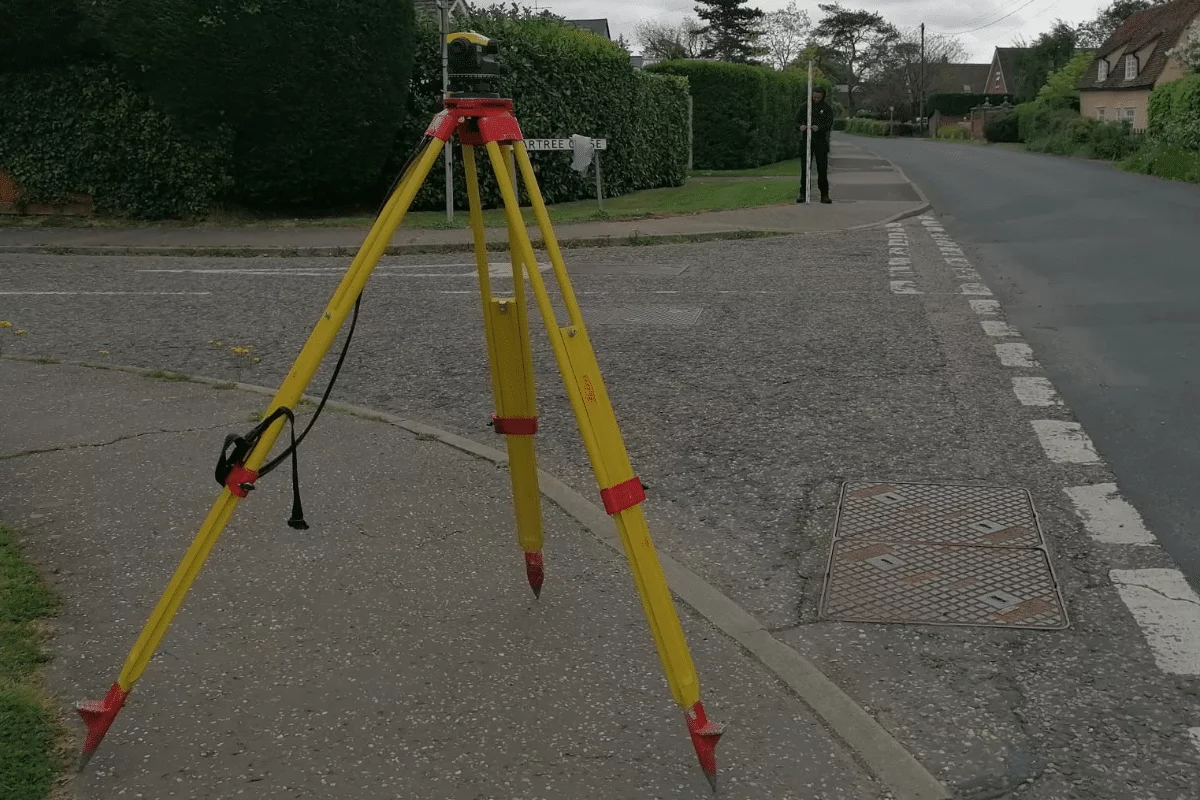
This unit introduces students to the fundamental principles and practical techniques of levelling in surveying. Levelling is a key operation used to determine height differences between points on the Earth's surface. It plays a crucial role in construction, civil engineering, and topographic mapping.
The unit covers the theory behind levelling, types of levelling (such as differential, fly, and profile levelling), and the proper use of levelling instruments including the dumpy level, automatic level, and levelling staff. Students will gain hands-on experience in setting up and using equipment, recording field observations, calculating reduced levels using the height of collimation and rise and fall methods, and identifying common errors.
By the end of this unit, learners will be able to perform basic levelling tasks, interpret levelling data accurately, and understand the significance of levelling in real-world engineering and land surveying projects.